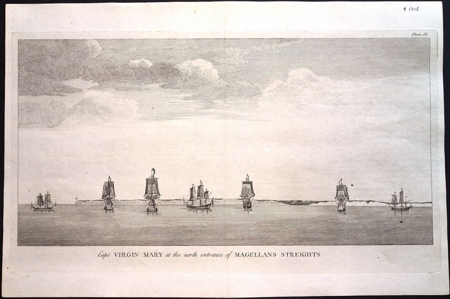
Antique map, Seale / Anson, Cape Virgin Mary/entrance of Magellan\'s Streights

When you click on links to various merchants on this site and make a purchase, this can result in this site earning a commission. Affiliate programs and affiliations include, but are not limited to, the eBay Partner Network.
Antique map, Seale / Anson, Cape Virgin Mary/entrance of Magellan\'s Streights:
$123.32
Description:
Antique map - FULL TITLE: A Voyage round the world in the years MDCCXL, I, II, III, IV, by George Anson Esq. now Lord Anson, commander in chief of a squadron of his Majesty’s ships, sent upon an expedition to the South Seas. Compiled from his papers and materials by Richard Walter, M.A., chaplain of his Majesty’s ship the Centurion, in that expedition. Printed for the author by John and Paul Knapton, in Ludgate Street, London in 1749.
The engraving shows a view of Cape Virgin Mary, in Argentina; that being a superior visual aid at the time when navigational instruments were highly inaccurate. Walter writes, ‘…This Cape is the northern boundary of the entrance of the Streights of Magellan. … where (a) represents the Cape itself.’
In all probability the point (a) shows Punta Dungeness, being the southern tip of the South American Continent, from the Atlantic side, administered by both Chile and Argentina. Cabo Virgenes is a few kilometres north of this point.
From the 5th edition of this narrative. The maps and views were engraved by R W Seale.
Condition: The engraving has been washed, de-acidified & pressed and is in excellent condition.
Conditon: GG
Cartographer: Seale. R W / Anson. G.
Date: 1748
Technique: Copper Engraving
Colour: Uncoloured
Width (cms) x Height (cms): 38.2 x 19.1
Ref: JJB1718
Antique map, Seale / Anson, Cape Virgin Mary/entrance of Magellan\'s Streights:
$123.32
